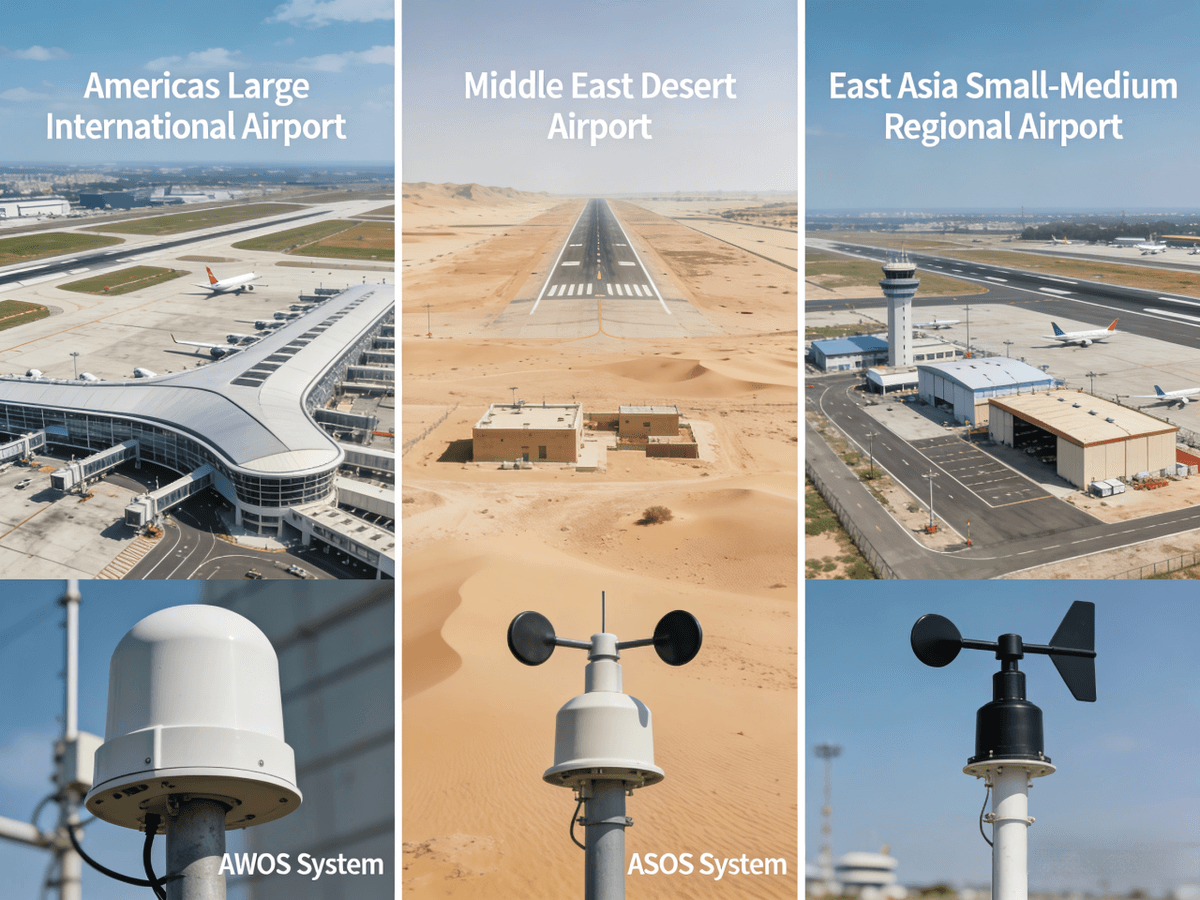
Automated Weather Observation Systems (AWOS) and Automated Surface Observing Systems (ASOS) are the unshakable foundations of aviation weather monitoring, delivering real-time, accurate meteorological data that defines safe and efficient flight operations across every corner of the globe. For airports of all sizes—from small regional airfields in the Middle East to major international hubs in the Americas and East Asia—understanding AWOS and ASOS, their capabilities, differences, and optimal use cases is essential to elevating operational safety and cutting unnecessary costs.
In the dynamic world of aviation, weather is not just a factor—it is the single most critical variable that shapes every takeoff, landing, and route decision. Pilots, air traffic controllers (ATCs), and airport managers rely on the unbroken stream of data from AWOS and ASOS to avoid turbulence, low visibility, sudden wind shifts, and unexpected storm systems that could turn a routine flight into a crisis. Unlike manual weather observations, which are prone to human error, delays, and gaps in coverage, AWOS and ASOS operate 24/7/365, processing and disseminating standardized meteorological data that aligns with global aviation standards set by organizations like the Federal Aviation Administration (FAA), the World Meteorological Organization (WMO), and regional aviation authorities. This constant, reliable flow of information is why AWOS and ASOS have become non-negotiable components of modern aviation infrastructure, and why choosing the right system—AWOS or ASOS—for your airport’s specific needs is a decision that directly impacts safety, compliance, and operational efficiency.
To fully leverage the power of AWOS and ASOS, it is vital to move beyond surface-level knowledge and dive into the core definitions, technical capabilities, and unique strengths of each system. AWOS, the pioneer of automated aviation weather monitoring, was first certified by the FAA in the 1990s and has since evolved into a scalable solution with multiple service levels, each tailored to meet the specific needs of different airport types. ASOS, the more advanced successor, is a federally maintained system (a joint effort between the FAA, National Weather Service (NWS), and Department of Defense (DoD) in the US) designed to deliver the most comprehensive weather data available, making it the gold standard for high-traffic international airports. Both AWOS and ASOS collect critical meteorological parameters—including wind speed and direction, air temperature and humidity, atmospheric pressure, rainfall, visibility, and cloud conditions—but their scope, sensor capabilities, data integration, and operational use cases set them apart in meaningful ways. For airport stakeholders in the Americas, Middle East, East Asia, and beyond, this distinction is not just a matter of technical detail; it is the key to selecting a weather monitoring system that matches your airport’s traffic volume, budget, and safety requirements.
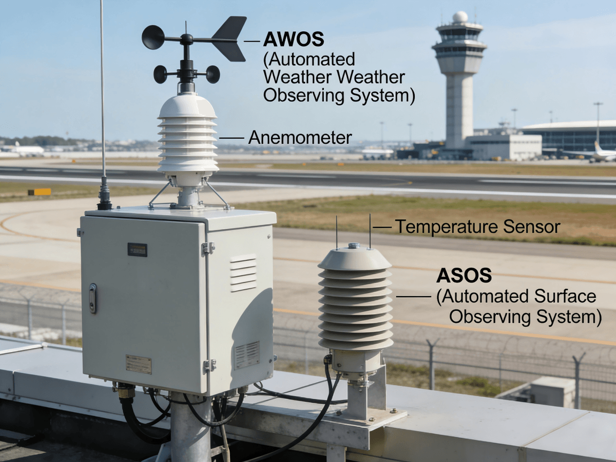
Let’s start with a deep dive into AWOS: the flexible, scalable automated weather solution that has become a staple for regional and small-to-medium airports worldwide. An Automated Weather Observation System (AWOS) is defined by the FAA as an air navigation facility that uses a computerized network of sensors to measure, analyze, and disseminate real-time weather parameters to pilots, ATCs, and airport operations teams. What makes AWOS stand out is its modular design: it is available in seven distinct service levels (from AWOS-A to AWOS-IIIPTZ), each equipped with a different array of sensors, allowing airports to choose a system that aligns perfectly with their operational needs and budget constraints. AWOS-A, the most basic level, only reports local altimeter settings—an essential parameter for altitude calibration—making it ideal for the smallest, low-traffic airfields. AWOS-I builds on this by adding wind speed and direction, temperature, dew point, and density altitude data, while AWOS-IIAV introduces precipitation detection. At the higher end, AWOS-III includes a ceilometer for measuring cloud height and coverage, AWOS-IIIP adds a precipitation discriminator that can distinguish between rain, drizzle, snow, and freezing rain, AWOS-IIIPT integrates a thunderstorm sensor for lightning detection, and AWOS-IIIPTZ rounds out the suite with a runway icing sensor—critical for airports in cold climates across North America, East Asia, and parts of the Middle East.
All AWOS systems operate on the same core principle: sensors collect raw weather data at regular intervals, a central processing unit analyzes the data to eliminate anomalies, and the final observations are disseminated to end users through multiple channels—including VHF radio, Automatic Terminal Information Service (ATIS), telephone dial-up, and aviation weather data networks. The sensors used in AWOS are rugged and designed to withstand harsh environmental conditions, from the extreme heat of the Middle Eastern deserts to the freezing cold of northern East Asia and the variable weather of the Americas. Wind speed and direction are measured by a cup and vane anemometer (or increasingly, ultrasonic anemometers, which have no moving parts and are more durable) mounted 10 meters above ground level, in an open area free from obstructions like buildings or hills to ensure accurate readings representative of runway conditions. Air temperature is measured using platinum resistance probes, which convert electrical resistance into precise temperature readings, while relative humidity sensors work in tandem with temperature data to calculate dew point— a key parameter for assessing fog and icing risks. Atmospheric pressure is measured by a barometer, with the QNH (altimeter setting adjusted to mean sea level) derived using the airport’s elevation and standard atmosphere specifications. Rainfall is tracked with a tipping bucket rain gauge, which generates an electronic pulse each time 0.2mm of precipitation accumulates, allowing for automatic, real-time reporting of rainfall amount and rate—no manual emptying required.
AWOS is a non-federal system, meaning it is purchased, installed, and maintained by state, local, or private airport authorities, rather than national aviation agencies. This makes it a highly flexible option for airports that want control over their weather monitoring infrastructure and do not require the full suite of capabilities offered by ASOS. For regional airports in the Middle East that handle a mix of commercial and general aviation, or small airfields in East Asia that serve local communities and tourist destinations, AWOS provides the perfect balance of functionality and cost-effectiveness. It eliminates the need for manual weather observations, reducing the risk of human error and ensuring that weather data is available around the clock, even when staff is limited. AWOS data is used to generate simplified weather reports, support ATIS broadcasts, and inform pilot decisions for takeoff and landing—all while remaining easy to install and maintain, with minimal technical expertise required for day-to-day operations. For airports looking to upgrade their weather monitoring capabilities without a massive upfront investment, AWOS is the ideal starting point, and many airports choose to scale up their AWOS system over time, adding higher-level sensors as their traffic volume and operational needs grow.
If AWOS is the flexible workhorse of aviation weather monitoring, then ASOS is the high-performance, comprehensive solution that powers the world’s busiest international airports. An Automated Surface Observing System (ASOS) is the gold standard of automated weather observation, a fully integrated, federally maintained system that delivers the most detailed, accurate, and standardized meteorological data available for aviation operations. Developed to meet the strictest global aviation standards, ASOS is a joint initiative between national aviation and meteorological agencies (such as the FAA, NWS, and DoD in the US) and is designed to support the complex, high-volume flight operations of major airports in the Americas, Middle East, East Asia, and beyond. What sets ASOS apart from AWOS is its all-inclusive sensor array and its ability to generate official METAR (Meteorological Terminal Aviation Routine Weather Report) and SPECI (Special Weather Report) observations—the global standard for aviation weather reporting, used by pilots, airlines, and meteorological agencies worldwide. Every ASOS system matches or exceeds the capabilities of the highest-level AWOS (AWOS-III), and many include additional advanced sensors that make it the most comprehensive weather monitoring system in aviation.
ASOS is a fully automated system that operates without any human intervention, collecting, processing, and disseminating real-time weather data 24/7. Its sensor array includes all the core components of a high-level AWOS—anemometers for wind data, platinum resistance probes for temperature, barometers for atmospheric pressure, tipping bucket rain gauges for rainfall, ceilometers for cloud height and coverage, and precipitation discriminators—plus advanced sensors for long-range visibility measurement, runway visual range (RVR) calculation (critical for Category II and III airports with instrument landing systems), freezing rain detection, and thunderstorm monitoring. Unlike AWOS, which is available in modular levels, ASOS is a turnkey solution with a fixed, comprehensive sensor suite, ensuring that no critical weather parameter is missed. This makes it ideal for major international airports, such as those in New York, Dubai, Tokyo, and Shanghai, which handle hundreds of flights per day and require the most detailed weather data to support safe, efficient air traffic management.

ASOS data is disseminated through all major aviation weather channels, including VHF radio, ATIS, the National Weather Data Network (in the US), and global aviation weather servers, making it accessible to pilots, airlines, ATCs, and meteorological agencies worldwide. In addition to supporting flight operations, ASOS data is also used by national weather services to prepare weather forecasts and severe weather warnings, making it a vital component of both aviation and general meteorological infrastructure. For example, in the Middle East, ASOS data from major airports like Dubai International and Abu Dhabi International is used to track sandstorms—a common weather hazard that can severely impact visibility—while in East Asia, ASOS systems monitor typhoons and monsoons, providing early warning of extreme weather that could disrupt flight operations. In the Americas, ASOS data is critical for tracking tornadoes, thunderstorms, and winter weather, ensuring that airports across the US, Canada, and Latin America have the information they need to keep flights safe.
One of the most important distinctions between AWOS and ASOS is their maintenance and governance model. AWOS is a non-federal system, owned and operated by local or private airport authorities, with maintenance and upgrades handled by the airport or third-party vendors. This gives airports complete control over their AWOS system but also places the responsibility for maintenance and sensor calibration on the airport. ASOS, by contrast, is a federally maintained system (in the US and many other countries), with installation, calibration, maintenance, and upgrades handled by national aviation and meteorological agencies. This means that ASOS users do not have to worry about day-to-day maintenance or sensor accuracy— the federal agency takes care of it—making it a low-maintenance option for major airports that do not have the in-house technical team to manage a complex weather system. However, this federal oversight also means that ASOS is less flexible than AWOS; airports cannot customize the sensor array or make changes to the system without approval from the federal agency, and the upfront and long-term costs are typically higher than AWOS, making it less accessible for small and regional airports.
Another key difference between AWOS and ASOS is their ability to integrate with other aviation infrastructure systems. ASOS is designed to seamlessly integrate with critical aviation tools, such as air traffic control systems, instrument landing systems (ILS), runway lighting systems, and airport operations management software, making it a core component of a modern, connected airport. For example, ASOS data on visibility and cloud height can be automatically fed into an airport’s ILS system, adjusting the system’s settings to match current weather conditions and ensuring that pilots have the guidance they need for a safe landing. AWOS can also integrate with some aviation systems, but its integration capabilities are more limited, making it a better fit for airports with simpler infrastructure. For airports in the Middle East and East Asia that are investing in smart airport technology—including AI-powered air traffic management and automated flight operations—ASOS is the clear choice, as it provides the real-time, standardized data that these advanced systems need to operate effectively.
Now that we have explored the core definitions, capabilities, and differences between AWOS and ASOS, the next critical question is: how do you choose the right system for your airport? The answer depends on three key factors: your airport’s traffic volume and type, your operational needs and safety requirements, and your budget. For small, low-traffic regional airports and general aviation airfields—whether in the rural Americas, small cities in East Asia, or remote areas of the Middle East—AWOS is the optimal choice. Its modular design allows you to start with a basic system and add sensors as your airport grows, keeping upfront costs low and ensuring that you only pay for the capabilities you need. AWOS is also easy to maintain and operate, making it a great fit for airports with limited technical staff. For example, a small tourist airport in the Greek Islands (Europe) or a local airfield in Inner Mongolia (East Asia) would benefit greatly from an AWOS-I or AWOS-II system, which provides all the core weather data needed to support safe flight operations without the unnecessary complexity and cost of ASOS.
For medium-sized airports that handle a mix of commercial and general aviation traffic—such as regional hubs in the Middle East (e.g., Muscat International in Oman) or East Asia (e.g., Chiang Mai International in Thailand)—a mid-to-high level AWOS system (AWOS-III or AWOS-IIIP) is the perfect balance of functionality and cost. These systems provide advanced capabilities like cloud height measurement, precipitation discrimination, and thunderstorm detection, meeting the safety requirements of commercial aviation while remaining more affordable and flexible than ASOS. For major international airports and high-traffic hubs—such as Los Angeles International (Americas), Dubai International (Middle East), and Tokyo Haneda (East Asia)—ASOS is the only choice that can meet the rigorous safety and operational demands of hundreds of daily flights. Its comprehensive sensor array, federal maintenance, and seamless integration with advanced aviation infrastructure make it the gold standard for these airports, ensuring that they have the most accurate, real-time weather data available to support safe, efficient flight operations.
It is also important to consider the regional weather hazards that your airport faces when choosing between AWOS and ASOS. For airports in cold climates (e.g., Toronto in Canada, Harbin in China) or areas with frequent icing (e.g., parts of the northern US), a high-level AWOS with a runway icing sensor (AWOS-IIIPTZ) or ASOS is essential to detect dangerous icing conditions on runways and taxiways. For airports in arid regions (e.g., Riyadh in Saudi Arabia, Phoenix in the US) that face frequent sandstorms or dust devils, ASOS’s long-range visibility sensors are critical for tracking these hazards and providing early warning to pilots. For airports in tropical regions (e.g., Singapore, Miami) that experience frequent thunderstorms and heavy rainfall, both AWOS and ASOS with precipitation discriminators and thunderstorm sensors are necessary to monitor these conditions and ensure safe flight operations. By aligning your weather monitoring system with the unique weather challenges of your region, you can maximize safety and minimize flight disruptions caused by unexpected weather events.
In today’s global aviation industry, the importance of AWOS and ASOS cannot be overstated. These two automated weather observing systems are the backbone of safe flight operations, providing the real-time, accurate meteorological data that pilots, ATCs, and airport managers need to make informed decisions. As aviation technology continues to evolve—with the rise of AI-powered weather forecasting, drone operations, and smart airport infrastructure—the role of AWOS and ASOS will only become more critical. AI and machine learning algorithms are already being integrated with AWOS and ASOS systems, allowing for more accurate weather predictions and early warning of severe weather events. For example, machine learning models can analyze historical AWOS and ASOS data to identify patterns in weather conditions, helping meteorologists predict fog, sandstorms, or thunderstorms with greater accuracy and lead time. This integration of AI with AWOS and ASOS is transforming aviation weather monitoring, making it more proactive and less reactive, and helping airports across the Americas, Middle East, and East Asia reduce flight disruptions and improve safety.
Drone operations are another area where AWOS and ASOS are playing an increasingly important role. As drone usage grows for commercial, industrial, and recreational purposes—especially near airports—drone operators rely on AWOS and ASOS data to make safe go/no-go decisions. AWOS and ASOS data on wind speed and direction, visibility, cloud height, and precipitation is critical for drone operators, as drones are far more vulnerable to weather conditions than manned aircraft. For example, a drone operator conducting a utility inspection near an airport in the US will use AWOS data to check wind limits and visibility, while a drone operator in the Middle East will use ASOS data to track sandstorms that could damage drone sensors or disrupt flight stability. In East Asia, where drone usage for delivery and agriculture is booming, AWOS and ASOS data is essential for ensuring that drone operations comply with regulatory requirements and remain safe. As drone regulations continue to evolve worldwide, AWOS and ASOS will become a mandatory part of drone operations near airports, further solidifying their role as a core component of aviation weather infrastructure.
For airport stakeholders looking to invest in AWOS or ASOS, it is essential to partner with a trusted, experienced provider of aviation weather solutions. A reputable provider will not only supply high-quality AWOS and ASOS systems but also offer comprehensive installation, calibration, maintenance, and support services, ensuring that your system operates at peak performance for years to come. They will also have a deep understanding of the unique weather challenges of your region—whether it’s the extreme heat of the Middle East, the typhoons of East Asia, or the winter weather of the Americas—and can customize your AWOS or ASOS system to meet those challenges. Additionally, a top provider will stay up-to-date with the latest aviation technology and regulatory changes, ensuring that your AWOS or ASOS system remains compliant with global aviation standards and can integrate with the latest smart airport infrastructure.
In conclusion, Automated Weather Observation Systems (AWOS) and Automated Surface Observing Systems (ASOS) are the two most important automated weather monitoring systems in aviation, each with its own unique strengths, capabilities, and use cases. AWOS is the flexible, scalable solution that is perfect for small and regional airports, offering a modular design that aligns with budget and operational needs, while ASOS is the comprehensive, high-performance gold standard for major international airports, providing the most detailed, standardized weather data available to support complex flight operations. For airports across the Americas, Middle East, and East Asia, understanding the differences between AWOS and ASOS is essential to selecting the right system—one that maximizes safety, minimizes costs, and supports the long-term growth of your airport.
In a world where aviation safety is non-negotiable and weather is an ever-present challenge, AWOS and ASOS are more than just technology—they are the guardians of safe flight operations. By investing in a high-quality AWOS or ASOS system, and partnering with a trusted provider, you can ensure that your airport has the real-time, accurate weather data it needs to keep flights safe, efficient, and on schedule, today and for years to come. Whether you are managing a small regional airfield or a major international hub, AWOS and ASOS are the foundation of a modern, safe, and connected airport— and the key to navigating the dynamic world of aviation weather with confidence.