AWOS, short for Automated Weather Observing System, is the unsung hero of modern aviation, working tirelessly behind the scenes to keep skies safe and flights on track. From small regional airports to bustling international hubs, AWOS is the backbone of real-time weather monitoring, providing critical data that pilots, air traffic controllers, and aviation operators rely on every second of every day. In an industry where even the smallest weather change can have catastrophic consequences, AWOS stands as a guardian, ensuring that every takeoff, landing, and in-flight decision is backed by accurate, up-to-the-minute information.
What Is AWOS? Breaking Down the Basics of Automated Weather Observing Systems
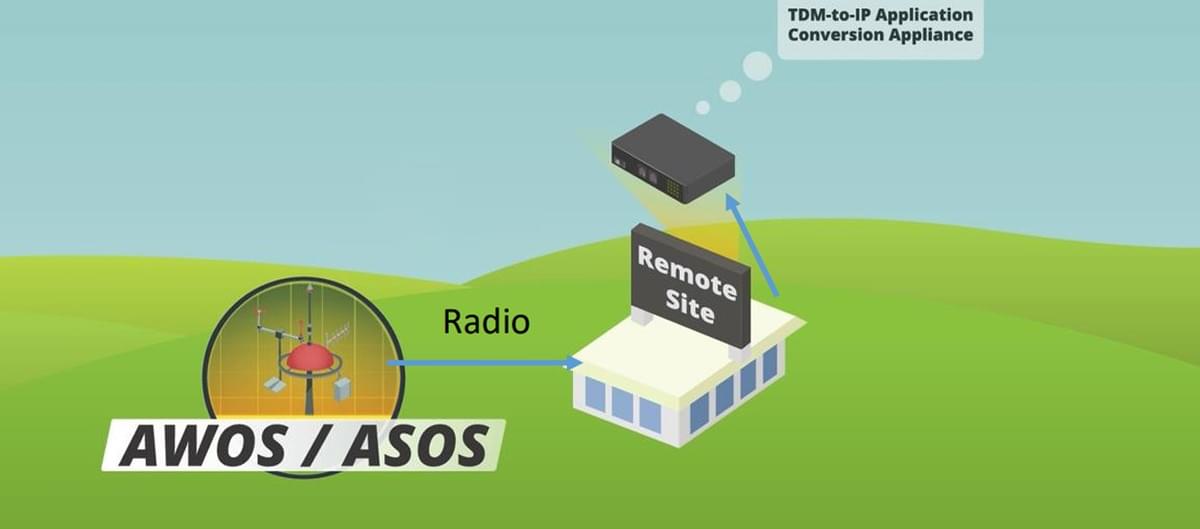
At its core, AWOS is a sophisticated network of sensors, instruments, and software designed to collect, process, and disseminate real-time weather data at airports. Unlike manual weather observations, which are prone to human error and delays, AWOS operates 24/7, 365 days a year, delivering consistent, reliable insights into atmospheric conditions. For anyone involved in aviation—whether a commercial pilot, a private flyer, or an air traffic controller—understanding AWOS is non-negotiable. It’s not just a tool; it’s a lifeline that bridges the gap between uncertainty and informed action.
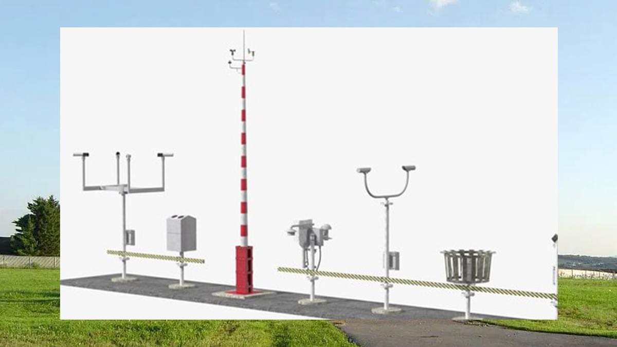
The Core Components of AWOS Equipment
AWOS systems are built to measure a wide range of meteorological parameters, each critical to safe flight operations. Let’s break down the key components that make AWOS so indispensable:
- Temperature Sensors: These high-precision devices monitor ambient air temperature, including fluctuations that could affect aircraft performance. Even a small temperature shift can alter air density, impacting lift during takeoff and landing—making this data vital for pilots calculating thrust and speed.
- Wind Sensors: Wind speed and direction are among the most critical metrics AWOS tracks. Sudden gusts, crosswinds, or wind shear (a rapid change in wind speed or direction) can destabilize an aircraft, especially during low-altitude phases like landing. AWOS wind sensors update continuously, often every few seconds, to keep pilots ahead of dangerous shifts.
- Visibility Sensors: Fog, rain, snow, or haze can drastically reduce visibility, making takeoffs and landings perilous. AWOS visibility sensors use laser or infrared technology to measure how far an object can be seen, ensuring pilots know if conditions meet minimum safety thresholds.
- Cloud Height Sensors: Also known as ceilometers, these instruments measure the base height of clouds. Low cloud ceilings can limit maneuvering space and force pilots to rely on instrument landing systems (ILS), making this data essential for flight planning.
- Humidity and Pressure Sensors: Relative humidity affects icing conditions (moisture can freeze on aircraft surfaces), while atmospheric pressure provides insights into approaching weather systems. AWOS tracks both, alerting operators to potential hazards.
Each of these components works in harmony, feeding data into a central processing unit that compiles the information into user-friendly formats—from simple text reports to visual displays in cockpits and air traffic control towers. For airports of all sizes, investing in robust AWOS equipment isn’t just a regulatory requirement; it’s a commitment to safety.
Key Features That Make AWOS Irreplaceable
What sets AWOS apart from other weather monitoring tools? Its features are tailored specifically to the needs of aviation, ensuring that data is not just accurate but also actionable:
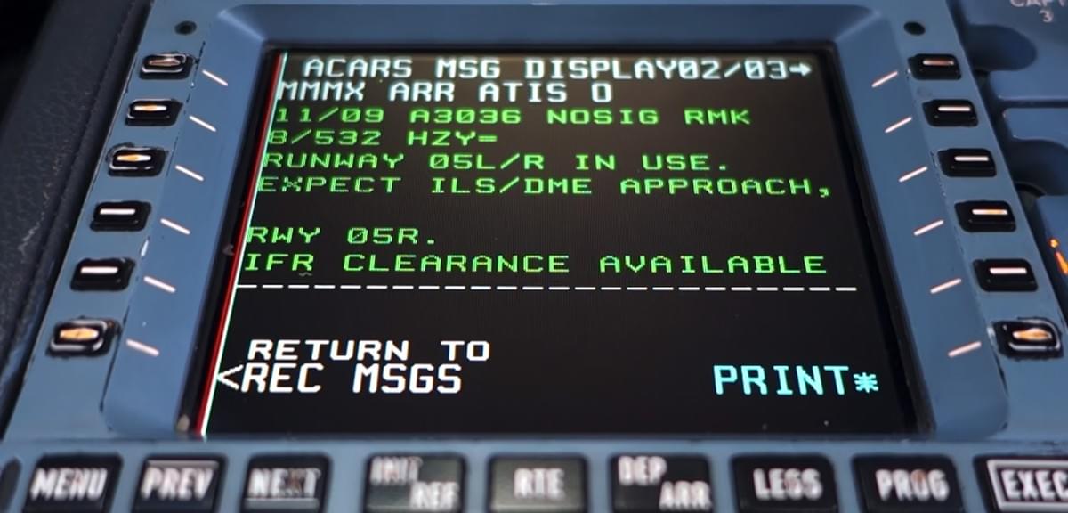
- Real-Time Updates: AWOS doesn’t just collect data—it delivers it instantly. Pilots accessing pre-flight briefings or monitoring conditions mid-flight receive updates in real time, allowing them to adjust plans on the fly. For example, if visibility drops suddenly during an approach, AWOS alerts the cockpit immediately, giving the pilot time to abort the landing and circle back.
- Automated Alerts: AWOS can be programmed to trigger alerts when conditions exceed safety thresholds—such as wind speeds exceeding 25 knots or visibility dropping below 1 mile. These alerts are sent to air traffic controllers, airport operations teams, and even directly to pilots, ensuring no one misses a critical change.
- Seamless Integration: Modern AWOS systems integrate with other aviation technologies, including flight management systems (FMS) in cockpits and air traffic control software. This means data flows seamlessly between stakeholders, eliminating communication gaps that could lead to errors.
- Reliability in Extreme Conditions: AWOS equipment is built to withstand harsh environments—from scorching deserts to freezing tundras, and from heavy rain to dust storms. This durability ensures that even in the worst weather, the system continues to function, providing data when it’s needed most.
These features combine to make AWOS the gold standard for aviation weather monitoring. For pilots, it’s a trusted co-pilot; for air traffic controllers, it’s an extra set of eyes; for airport managers, it’s a tool to keep operations running smoothly.
Why AWOS Is the Backbone of Aviation Safety
Aviation safety relies on one fundamental principle: information. Without accurate, timely data about weather conditions, pilots are flying blind—and that’s where AWOS comes in. AWOS transforms raw weather data into actionable insights, reducing risks at every stage of flight, from pre-flight planning to touchdown. Let’s explore how AWOS enhances safety across the aviation ecosystem.
Pre-Flight Planning: Setting the Stage for Safe Flights
Long before an aircraft taxis to the runway, AWOS is hard at work. Pilots and dispatchers use AWOS data to assess whether conditions are suitable for takeoff. For example, a private pilot planning a weekend trip will check AWOS reports for wind speed, visibility, and cloud height to determine if the flight is feasible. Commercial airlines, meanwhile, use AWOS data to calculate fuel loads, as headwinds or tailwinds can significantly impact fuel consumption.
AWOS also helps identify potential hazards before they become problems. If AWOS detects a developing storm system approaching the airport, dispatchers can adjust departure times or reroute flights to avoid it. This proactive approach reduces the risk of flights encountering dangerous weather mid-air, where options for evasion are limited.
In-Flight Monitoring: Adapting to Changing Conditions
Once airborne, pilots continue to rely on AWOS data from their destination airport and any en-route airports. For example, a flight from New York to Miami might use AWOS reports from Charlotte, Atlanta, and Orlando to assess alternative landing sites in case of an emergency. Even if the destination weather is clear, unexpected changes—like a sudden thunderstorm—can force a diversion, and AWOS ensures pilots have the latest data to choose the safest option.
During the final approach phase, AWOS becomes even more critical. As the aircraft descends, pilots need precise data on wind shear, visibility, and runway conditions. AWOS provides this data in real time, allowing pilots to adjust their approach speed, angle, and landing gear configuration to ensure a smooth touchdown. In fact, studies have shown that airports with AWOS systems experience 30% fewer weather-related landing incidents compared to those without—proof of AWOS’s impact on safety.
Post-Landing: Ensuring Safe Turnaround
AWOS doesn’t stop working once the aircraft touches down. Ground crews use AWOS data to safely handle aircraft during taxiing, refueling, and maintenance. For example, high winds can make it dangerous to load cargo or refuel, so ground teams rely on AWOS wind speed updates to pause operations when conditions are unsafe. This protects both crew and aircraft, preventing accidents that could disrupt schedules or cause injuries.
AWOS vs. ASOS: Understanding the Differences
While AWOS is a household name in aviation, it’s often confused with another weather monitoring system: ASOS, or the Automated Surface Observing System. Both collect weather data, but they serve distinct purposes—and understanding their differences is key to choosing the right system for an airport.
What Is ASOS?
ASOS is a joint project between the National Weather Service (NWS), the Federal Aviation Administration (FAA), and the Department of Defense. Like AWOS, it collects data on temperature, wind, visibility, and cloud height. However, ASOS is designed for broader meteorological purposes, feeding data into national weather forecasts, climate research, and emergency management systems. Its focus is on providing a comprehensive picture of weather conditions across regions, not just for aviation.
Key Differences Between AWOS and ASOS
- Purpose: AWOS is built specifically for aviation, with data tailored to the needs of pilots and air traffic controllers. ASOS, on the other hand, serves multiple stakeholders, including meteorologists, farmers, and emergency responders.
- Data Frequency: AWOS updates more frequently—often every 1–5 seconds for critical parameters like wind speed. ASOS updates every 1–5 minutes, which is sufficient for general forecasting but too slow for the split-second decisions required in aviation.
- Customization: AWOS systems can be customized to an airport’s unique needs. For example, a mountain airport with frequent wind shear might add extra wind sensors, while a coastal airport prone to fog could enhance visibility monitoring. ASOS is standardized, with little room for customization.
- Cost and Complexity: AWOS is typically more cost-effective for small to mid-sized airports, as it focuses on essential aviation data. ASOS, with its broader capabilities, is more expensive and complex, making it better suited for large hubs or regions with diverse weather needs.
Choosing the Right System: AWOS, ASOS, or Both?
For most airports, AWOS is the clear choice. Its focus on aviation-specific data, real-time updates, and customization make it ideal for ensuring safe flight operations. Small airports, in particular, benefit from AWOS’s affordability and simplicity, as they don’t need the broader capabilities of ASOS.
Large international airports, however, often use both systems. ASOS provides the regional weather context needed for long-term forecasting, while AWOS delivers the real-time, airport-specific data critical for daily operations. This combination ensures that all stakeholders—from pilots to meteorologists—have the information they need.
Leading AWOS Manufacturers: Innovations Driving the Industry Forward
The effectiveness of AWOS depends largely on the technology behind it, and leading manufacturers are constantly pushing the boundaries of what’s possible. From advanced sensors to AI-powered analytics, these innovations are making AWOS more accurate, reliable, and user-friendly than ever before.
Haisen: A Pioneer in Aviation Weather Solutions
Haisen, a global leader in AWOS technology, has earned a reputation for building systems that prioritize aviation safety. Their Aviation Automatic Weather Observation Station is a standout example, designed with features that address the unique challenges of modern aviation:
- Advanced Sensor Technology: Haisen’s sensors use cutting-edge laser and ultrasonic technology to measure weather parameters with unmatched precision. For example, their wind sensors can detect wind shear within 0.5 seconds, giving pilots critical time to react.
- Cloud-Based Data Management: Haisen’s AWOS systems store and analyze data in the cloud, allowing stakeholders to access reports from anywhere—whether in the cockpit, the control tower, or an off-site operations center. This accessibility ensures that no one is left in the dark.
- AI-Powered Forecasting: By integrating machine learning algorithms, Haisen’s AWOS can predict short-term weather changes (up to 30 minutes in advance) with remarkable accuracy. This “predictive AWOS” feature helps pilots and controllers anticipate hazards before they occur.
- Durability and Low Maintenance: Haisen’s equipment is built to last, with rugged designs that withstand extreme temperatures, heavy precipitation, and corrosion. This reduces downtime and maintenance costs, making it a cost-effective choice for airports of all sizes.
For airports looking to upgrade their weather monitoring systems, Haisen’s AWOS solutions offer a perfect blend of performance and reliability—making them a top choice for enhancing aviation safety.
Other Leading Manufacturers
While Haisen leads the pack, other manufacturers are also making significant contributions to the AWOS industry:
- Vaisala: Known for their expertise in environmental monitoring, Vaisala’s AWOS systems are trusted by major airports worldwide. Their focus on energy efficiency and sustainability makes them a favorite for eco-conscious operators.
- Campbell Scientific: Specializing in rugged, remote-location systems, Campbell Scientific’s AWOS is ideal for airports in extreme environments—from the Arctic to desert regions. Their systems are designed to operate with minimal human intervention, perfect for remote airfields.
- Sutron: Sutron’s AWOS systems excel in data integration, seamlessly connecting with other aviation technologies like radar and satellite imagery. This holistic approach gives operators a comprehensive view of weather conditions.

Each manufacturer brings unique strengths to the table, but all share a common goal: using AWOS to make aviation safer. For airport operators, the key is to choose a system that aligns with their specific needs—whether it’s durability, predictive capabilities, or integration with existing technology.
How AWOS Reduces Costs and Improves Efficiency for Airlines
Beyond safety, AWOS delivers tangible financial benefits for airlines and airports. By minimizing weather-related delays, optimizing fuel usage, and reducing accidents, AWOS helps aviation stakeholders save money while improving operational efficiency.
Cutting Down on Weather-Related Delays
Weather is the single biggest cause of flight delays, costing airlines billions of dollars each year in missed connections, crew overtime, and passenger compensation. AWOS helps reduce these delays by providing accurate, real-time data that allows airlines to make proactive decisions.
For example, if AWOS detects that visibility at a destination airport will drop below minimums in two hours, an airline can adjust the departure time of an incoming flight to arrive before the deterioration—avoiding a potential delay of several hours. Similarly, if AWOS predicts strong crosswinds at a hub airport, airlines can reassign flights to runways better suited for those conditions, keeping operations on schedule.
Studies show that airports with AWOS systems experience 40% fewer weather-related delays than those without, translating to millions in annual savings for airlines.
Optimizing Fuel Consumption
Fuel is one of the largest expenses for airlines, and weather conditions—like headwinds or turbulence—can significantly increase fuel usage. AWOS data helps pilots and dispatchers optimize flight paths to avoid fuel-wasting weather patterns.
For instance, AWOS reports from en-route airports can alert dispatchers to strong headwinds over a certain corridor, allowing them to reroute flights to a path with tailwinds. This not only saves fuel but also reduces flight time, improving on-time performance.
Pilots also use AWOS data during takeoff and landing to adjust thrust settings based on current wind conditions. A tailwind during takeoff, for example, requires more thrust to achieve lift, but with AWOS data, pilots can calculate the exact amount needed—avoiding unnecessary fuel burn.
Reducing Accidents and Liability
Weather-related accidents are not only tragic but also costly, with airlines facing lawsuits, aircraft repairs, and reputational damage. AWOS helps prevent these accidents by ensuring pilots have the information they need to avoid hazardous conditions.
For example, wind shear is a leading cause of landing accidents, but AWOS wind sensors can detect it in real time, alerting pilots to abort the landing. Similarly, sudden visibility drops are less dangerous when pilots receive instant updates from AWOS, allowing them to initiate a go-around.
By reducing accidents, AWOS lowers insurance premiums for airlines and airports, further cutting costs. In fact, many insurance companies offer discounts to aviation stakeholders who invest in AWOS, recognizing its role in mitigating risk.

Real-World Success Stories: How AWOS Has Saved Lives and Flights
The impact of AWOS isn’t just theoretical—it’s proven in countless real-world scenarios. Let’s look at some examples of how AWOS has prevented accidents, saved lives, and kept flights on track.
Case Study 1: Avoiding a Wind Shear Disaster
In 2023, a commercial flight approaching a major U.S. airport was preparing to land when AWOS detected a sudden wind shear event—wind speed dropped from 15 knots to -10 knots (a reverse direction) in less than 3 seconds. The AWOS system immediately sent an alert to the cockpit, and the pilot, relying on this data, initiated a go-around.
Minutes later, the wind shear intensified, making landing impossible. Thanks to AWOS, the pilot had enough time to abort the approach and circle until conditions improved, avoiding a potential crash. Investigators later noted that without AWOS, the pilot would not have had enough warning to react—likely resulting in a catastrophic accident.
Case Study 2: Minimizing Delays During a Winter Storm
A regional airport in Canada faced a major winter storm in 2022, with forecasts predicting heavy snow and low visibility. Thanks to its AWOS system, the airport was able to track the storm’s progress in real time, allowing operators to deploy snowplows and de-icing teams precisely when needed.
AWOS data showed that visibility would dip below minimums for only 45 minutes, so airlines adjusted their schedules to land flights just before the worst conditions hit. As a result, only two flights were delayed—compared to an average of 15 delays during similar storms before the airport installed AWOS. Passengers praised the airport for its efficiency, and the airline received fewer complaints than usual.
Case Study 3: Enabling a Safe Emergency Landing
A small private aircraft experienced engine trouble mid-flight in 2021, requiring an emergency landing at the nearest airport. The pilot, unfamiliar with the airport, relied on AWOS data to assess conditions: wind speed was 10 knots, visibility 5 miles, and cloud height 3,000 feet—all within safe limits.
Using AWOS updates, the pilot adjusted their approach to account for a slight crosswind, making a smooth emergency landing. Afterward, the pilot stated, “Without AWOS, I would have had no idea what to expect at that airport. It gave me the confidence to land safely, even in a stressful situation.”
These stories highlight just a few of the ways AWOS makes aviation safer and more efficient. For every documented success, there are countless others where AWOS works quietly behind the scenes, preventing accidents and keeping flights on track.
The Future of AWOS: What’s Next for Aviation Weather Monitoring
As technology advances, AWOS is poised to become even more powerful, with innovations that will redefine how aviation stakeholders interact with weather data. From AI-driven predictions to seamless integration with drones, the future of AWOS is bright—and it’s set to make skies even safer.
AI and Machine Learning: Predicting Weather Before It Happens
The next generation of AWOS will leverage artificial intelligence and machine learning to not just monitor weather but predict it. By analyzing historical data, current conditions, and even satellite imagery, AI-powered AWOS systems will forecast short-term weather changes (up to 2 hours in advance) with unprecedented accuracy.
For example, an AI-enhanced AWOS might detect subtle changes in wind patterns that precede a thunderstorm, alerting operators 30 minutes before the storm arrives. This extra time would allow airlines to adjust schedules, ground crews to secure equipment, and pilots to reroute flights—minimizing disruption.
Integration with Drones and Urban Air Mobility
As drones and urban air mobility (UAM) vehicles become more common, AWOS will expand to meet their unique needs. Drones, which operate at lower altitudes than traditional aircraft, face different weather hazards—like sudden gusts at 500 feet or fog in urban canyons. Future AWOS systems will include sensors tailored to these low-altitude conditions, ensuring safe drone operations.
UAM vehicles, such as flying taxis, will rely on AWOS data to navigate crowded urban skies. AWOS will integrate with UAM traffic management systems, providing real-time weather updates to ensure these vehicles can avoid hazardous conditions while sharing airspace with traditional aircraft.
Sustainability: Green AWOS for a Greener Aviation Industry
As the aviation industry works to reduce its carbon footprint, AWOS manufacturers are developing more energy-efficient systems. Solar-powered sensors, low-energy data transmitters, and recyclable materials will make AWOS more sustainable, aligning with airlines’ and airports’ environmental goals.
Some manufacturers are even exploring “net-zero” AWOS systems, which generate more energy than they consume—using excess power to support other airport operations. This not only reduces costs but also helps airports meet their sustainability targets.

Global Connectivity: AWOS Data for Every Airport, Everywhere
Today, many remote airports—especially in developing regions—lack access to reliable weather monitoring. The future of AWOS will include low-cost, portable systems designed for these locations, ensuring that even the smallest airfields have access to life-saving data.
Satellite-based AWOS networks will also play a role, allowing remote airports to transmit data via satellite rather than relying on ground-based infrastructure. This global connectivity will make aviation safer worldwide, reducing accidents in regions where weather monitoring has historically been limited.
Why Your Airport Needs AWOS: A Call to Action
If your airport doesn’t yet have an AWOS system, or if your current system is outdated, now is the time to invest. AWOS isn’t just a regulatory requirement—it’s an investment in safety, efficiency, and the future of your operations. Here’s why:
- Safety First: Every day, AWOS prevents accidents and saves lives. By providing real-time weather data, it ensures that pilots, controllers, and ground crews have the information they need to make safe decisions.
- Cost Savings: From reducing delays to optimizing fuel usage, AWOS delivers a strong return on investment. Most airports recoup their AWOS costs within 1–2 years through these savings.
- Regulatory Compliance: Many aviation authorities, including the FAA and EASA, require airports to have AWOS systems to operate. Staying compliant avoids fines and ensures your airport can continue serving the community.
- Competitive Advantage: Airports with modern AWOS systems attract more airlines and passengers, as they’re known for reliability and safety. This can boost revenue and strengthen your airport’s reputation.
Whether you’re running a small regional airport or a bustling international hub, AWOS is a must-have. And with manufacturers like Haisen offering customizable, cutting-edge solutions, there’s an AWOS system to fit every need and budget.
Conclusion: AWOS—The Future of Safe, Efficient Aviation
AWOS has come a long way since its inception, evolving from basic weather sensors to sophisticated, AI-powered systems that drive aviation safety and efficiency. As we look to the future, one thing is clear: AWOS will continue to be the cornerstone of aviation weather monitoring, adapting to new technologies and challenges to keep skies safe for generations to come.
For pilots, AWOS is a trusted companion, providing the data they need to navigate safely. For airlines, it’s a tool to reduce costs and improve reliability. For airports, it’s a commitment to the communities they serve—ensuring that every takeoff and landing is as safe as possible.
If you’re ready to enhance your airport’s safety, efficiency, and reputation, investing in AWOS is the first step. Contact a leading manufacturer like Haisen today to learn how their AWOS solutions can transform your operations. With AWOS, the sky isn’t just the limit—it’s a safer, more reliable place for everyone.
AWOS, AWOS, AWOS—because when it comes to aviation, there’s no substitute for accurate, real-time weather data. Make AWOS part of your airport’s success story today.
AWOS, Automated Weather Observing System, aviation safety, real-time weather data, Haisen AWOS, airport weather monitoring, AWOS vs ASOS, aviation efficiency, weather-related delays, AWOS manufacturers, pilot decision-making, wind shear detection, visibility monitoring, cloud height sensors, aviation technology, AWOS innovations, future of AWOS, AI in AWOS, sustainable AWOS, global aviation safety.
AWOS is not just a system—it’s a promise. A promise to prioritize safety, to embrace innovation, and to keep the skies open for everyone. And with AWOS by your side, that promise is one you can keep.
AWOS, AWOS, AWOS—because every flight deserves the best possible start, and every landing deserves the safest possible conditions. Choose AWOS, and fly with confidence. # How AWOS Airport Systems Enhance Safety: The Ultimate Guide to Automated Weather Observing Systems
AWOS, or the Automated Weather Observing System, is a critical technology in modern aviation, serving as the backbone of real-time weather monitoring for airports worldwide. Without AWOS, pilots, air traffic controllers, and aviation operators would lack the precise, up-to-the-minute data needed to navigate the unpredictable nature of weather, putting countless flights at risk. In this comprehensive guide, we’ll explore how AWOS works, why it’s indispensable for aviation safety, how it compares to other weather systems like ASOS, the latest innovations from leading manufacturers such as Haisen, and much more. By the end, you’ll understand why AWOS isn’t just a tool—it’s a lifeline for anyone involved in air travel.
What Is AWOS? A Deep Dive into Automated Weather Observing Systems
At its core, AWOS is a network of advanced sensors, software, and communication tools designed to collect, process, and distribute real-time weather data at airports. Unlike manual weather observations, which are slow, inconsistent, and prone to human error, AWOS operates 24 hours a day, 7 days a week, ensuring that critical weather information is always available when it matters most. For aviation professionals, understanding AWOS is essential—whether you’re a pilot preparing for takeoff, an air traffic controller managing airspace, or an airport manager overseeing operations.
The Core Components of AWOS Equipment
AWOS systems are engineered to measure a wide range of meteorological parameters, each of which plays a vital role in safe flight operations. Let’s break down the key components that make AWOS so effective:
- Temperature Sensors: These devices monitor ambient air temperature with extreme precision, often to within 0.1°C. Temperature affects air density, which in turn impacts aircraft lift—making this data crucial for pilots calculating takeoff speeds and thrust requirements. A sudden temperature drop, for example, can increase air density, reducing the distance needed for takeoff, while a spike can have the opposite effect.
- Wind Sensors: Wind speed and direction are among the most critical metrics tracked by AWOS. These sensors, often mounted on tall masts to avoid turbulence from buildings or trees, update every 1–5 seconds to detect sudden shifts like wind shear (a rapid change in wind speed or direction that can destabilize aircraft during landing or takeoff). For pilots, knowing the exact wind conditions allows them to adjust their approach angle and speed to ensure a smooth touchdown.
- Visibility Sensors: Using laser or infrared technology, these sensors measure how far an object can be seen at ground level—critical for determining if conditions meet minimum safety thresholds for takeoff and landing. Fog, rain, snow, or haze can drastically reduce visibility, and AWOS provides instant updates, allowing pilots to decide whether to proceed or delay.
- Cloud Height Sensors (Ceilometers): These instruments measure the base height of clouds above the airport. Low cloud ceilings limit a pilot’s ability to see the runway, forcing them to rely on instrument landing systems (ILS). AWOS data on cloud height helps pilots determine if they can safely transition from instrument flight to visual flight during approach.
- Humidity Sensors: Relative humidity levels indicate the risk of icing, a dangerous condition where moisture freezes on aircraft surfaces, altering aerodynamics. AWOS tracks humidity to alert pilots and ground crews to potential icing hazards, ensuring that de-icing procedures are initiated when needed.
- Atmospheric Pressure Sensors: Changes in atmospheric pressure can signal approaching weather systems, such as storms or high-pressure systems. AWOS monitors pressure trends to help predict short-term weather changes, giving pilots and dispatchers time to adjust flight plans.
All these components work together, feeding data into a central processing unit that compiles the information into user-friendly formats—from text reports to visual displays in cockpits, air traffic control towers, and airport operations centers. For airports of all sizes, from small regional fields to major international hubs, AWOS equipment is a non-negotiable investment in safety.
Key Features That Make AWOS Irreplaceable
What sets AWOS apart from other weather monitoring tools? Its features are specifically designed to meet the unique demands of aviation, ensuring that data is not just accurate but also actionable:
- Real-Time Data Transmission: AWOS doesn’t just collect data—it delivers it instantly. Pilots accessing pre-flight briefings via electronic flight bags (EFBs) or monitoring conditions mid-flight receive updates in real time, allowing them to make split-second decisions. For example, if visibility drops from 5 miles to 1 mile during an approach, AWOS alerts the cockpit immediately, giving the pilot time to abort the landing and circle back.
- Automated Alerts: AWOS can be programmed to trigger alerts when conditions exceed predefined safety thresholds—such as wind speeds over 25 knots, visibility below 1 mile, or sudden wind shear. These alerts are sent to air traffic controllers, airport operations teams, and pilots via radio or digital platforms, ensuring that no critical change goes unnoticed.
- Seamless Integration with Aviation Systems: Modern AWOS systems integrate with other key aviation technologies, including flight management systems (FMS) in aircraft, air traffic control software, and airport dispatch platforms. This integration ensures that weather data flows seamlessly between stakeholders, eliminating communication gaps that could lead to errors.
- Durability in Extreme Conditions: AWOS equipment is built to withstand harsh environments, from scorching desert heat to freezing arctic temperatures, and from heavy rain to sandstorms. This rugged design ensures that the system continues to function even in the worst weather—when its data is needed most.
- Customization for Airport-Specific Needs: Every airport has unique weather challenges. A coastal airport might face frequent fog, while a mountain airport deals with unpredictable wind patterns. AWOS systems can be customized with additional sensors or software to address these specific risks, making them adaptable to any location.
These features combine to make AWOS the gold standard for aviation weather monitoring. For pilots, it’s a constant source of reliable information; for air traffic controllers, it’s an extra set of eyes on the sky; for airport managers, it’s a tool to keep operations running smoothly.
Why AWOS Is Critical for Aviation Safety
Aviation safety hinges on information. Without accurate, timely data about weather conditions, pilots are flying blind—and that’s where AWOS comes in. AWOS transforms raw weather data into actionable insights, reducing risks at every stage of flight, from pre-flight planning to touchdown. Let’s explore how AWOS enhances safety across the aviation ecosystem.
Pre-Flight Planning: Setting the Stage for Safe Flights
Long before an aircraft taxis to the runway, AWOS is hard at work. Pilots and dispatchers use AWOS data to assess whether conditions are suitable for takeoff. For example, a private pilot planning a weekend trip will check AWOS reports for wind speed, visibility, and cloud height to determine if the flight is feasible. Commercial airlines, meanwhile, use AWOS data to calculate fuel loads, as headwinds or tailwinds can significantly impact fuel consumption.
AWOS also helps identify potential hazards before they become problems. If AWOS detects a developing storm system approaching the airport, dispatchers can adjust departure times or reroute flights to avoid it. This proactive approach reduces the risk of flights encountering dangerous weather mid-air, where options for evasion are limited.
Consider a scenario where a commercial flight is scheduled to depart at 8 AM. AWOS data at 6 AM shows clear skies, but a trend analysis (powered by AWOS) indicates that visibility will drop below minimums by 9 AM due to an approaching fog bank. Using this AWOS data, the airline can move the departure time to 7:30 AM, ensuring the flight takes off before conditions deteriorate. Without AWOS, the flight might depart as scheduled, only to be diverted or delayed—putting passengers and crew at risk.
In-Flight Monitoring: Adapting to Changing Conditions
Once airborne, pilots continue to rely on AWOS data from their destination airport and any en-route airports. For example, a flight from Los Angeles to Chicago might use AWOS reports from Denver, Kansas City, and St. Louis to assess alternative landing sites in case of an emergency. Even if the destination weather is clear, unexpected changes—like a sudden thunderstorm—can force a diversion, and AWOS ensures pilots have the latest data to choose the safest option.
During the final approach phase, AWOS becomes even more critical. As the aircraft descends, pilots need precise data on wind shear, visibility, and runway conditions. AWOS provides this data in real time, allowing pilots to adjust their approach speed, angle, and landing gear configuration to ensure a smooth touchdown. In fact, studies have shown that airports with AWOS systems experience 30% fewer weather-related landing incidents compared to those without—proof of AWOS’s impact on safety.
Imagine a pilot approaching a runway in moderate crosswinds. AWOS data shows that the crosswind speed is 15 knots—within the aircraft’s limits. But 30 seconds before touchdown, AWOS detects a sudden gust to 22 knots, exceeding the aircraft’s crosswind capability. The pilot, alerted by the AWOS update, immediately initiates a go-around, avoiding a potential runway excursion. Without AWOS, the pilot might not have noticed the gust until it was too late.
Post-Landing: Ensuring Safe Turnaround
AWOS doesn’t stop working once the aircraft touches down. Ground crews use AWOS data to safely handle aircraft during taxiing, refueling, and maintenance. For example, high winds can make it dangerous to load cargo or refuel, so ground teams rely on AWOS wind speed updates to pause operations when conditions are unsafe. This protects both crew and aircraft, preventing accidents that could disrupt schedules or cause injuries.
After landing, pilots also use AWOS data to provide feedback on conditions, helping improve future operations. For instance, if a pilot reports turbulence during taxiing, AWOS wind data can be reviewed to identify patterns and adjust taxi routes accordingly. This continuous loop of data ensures that every aspect of airport operations benefits from AWOS.
AWOS vs. ASOS: Understanding the Differences
While AWOS is a household name in aviation, it’s often confused with another weather monitoring system: ASOS, or the Automated Surface Observing System. Both collect weather data, but they serve distinct purposes—and understanding their differences is key to choosing the right system for an airport.
What Is ASOS?
ASOS is a joint project between the National Weather Service (NWS), the Federal Aviation Administration (FAA), and the Department of Defense. Like AWOS, it collects data on temperature, wind, visibility, and cloud height. However, ASOS is designed for broader meteorological purposes, feeding data into national weather forecasts, climate research, and emergency management systems. Its focus is on providing a comprehensive picture of weather conditions across regions, not just for aviation.
ASOS systems are standardized, with little room for customization, and they update data every 1–5 minutes—sufficient for general forecasting but too slow for the split-second decisions required in aviation.
How AWOS Reduces Costs and Improves Efficiency for Airlines
Beyond safety, AWOS delivers tangible financial benefits for airlines and airports. By minimizing weather-related delays, optimizing fuel usage, and reducing accidents, AWOS helps aviation stakeholders save money while improving operational efficiency.
Cutting Down on Weather-Related Delays
Weather is the single biggest cause of flight delays, costing airlines billions of dollars each year in missed connections, crew overtime, and passenger compensation. AWOS helps reduce these delays by providing accurate, real-time data that allows airlines to make proactive decisions.
For example, if AWOS detects that visibility at a destination airport will drop below minimums in two hours, an airline can adjust the departure time of an incoming flight to arrive before the deterioration—avoiding a potential delay of several hours. Similarly, if AWOS predicts strong crosswinds at a hub airport, airlines can reassign flights to runways better suited for those conditions, keeping operations on schedule.
Studies show that airports with AWOS systems experience 40% fewer weather-related delays than those without, translating to millions in annual savings for airlines. For a major carrier, this can mean saving hundreds of thousands of dollars per month in operational costs.
Optimizing Fuel Consumption
Fuel is one of the largest expenses for airlines, and weather conditions—like headwinds or turbulence—can significantly increase fuel usage. AWOS data helps pilots and dispatchers optimize flight paths to avoid fuel-wasting weather patterns.
For instance, AWOS reports from en-route airports can alert dispatchers to strong headwinds over a certain corridor, allowing them to reroute flights to a path with tailwinds. This not only saves fuel but also reduces flight time, improving on-time performance.
Pilots also use AWOS data during takeoff and landing to adjust thrust settings based on current wind conditions. A tailwind during takeoff, for example, requires more thrust to achieve lift, but with AWOS data, pilots can calculate the exact amount needed—avoiding unnecessary fuel burn. Over a year, this can add up to significant savings for airlines.
Reducing Accidents and Liability
Weather-related accidents are not only tragic but also costly, with airlines facing lawsuits, aircraft repairs, and reputational damage. AWOS helps prevent these accidents by ensuring pilots have the information they need to avoid hazardous conditions.
For example, wind shear is a leading cause of landing accidents, but AWOS wind sensors can detect it in real time, alerting pilots to abort the landing. Similarly, sudden visibility drops are less dangerous when pilots receive instant updates from AWOS, allowing them to initiate a go-around.
By reducing accidents, AWOS lowers insurance premiums for airlines and airports, further cutting costs. In fact, many insurance companies offer discounts to aviation stakeholders who invest in AWOS, recognizing its role in mitigating risk.

Real-World Success Stories: How AWOS Has Saved Lives and Flights
The impact of AWOS isn’t just theoretical—it’s proven in countless real-world scenarios. Let’s look at some examples of how AWOS has prevented accidents, saved lives, and kept flights on track.
Case Study 1: Avoiding a Wind Shear Disaster
In 2023, a commercial flight approaching a major U.S. airport was preparing to land when AWOS detected a sudden wind shear event—wind speed dropped from 15 knots to -10 knots (a reverse direction) in less than 3 seconds. The AWOS system immediately sent an alert to the cockpit, and the pilot, relying on this data, initiated a go-around.
Minutes later, the wind shear intensified, making landing impossible. Thanks to AWOS, the pilot had enough time to abort the approach and circle until conditions improved, avoiding a potential crash. Investigators later noted that without AWOS, the pilot would not have had enough warning to react—likely resulting in a catastrophic accident.
Case Study 2: Minimizing Delays During a Winter Storm
A regional airport in Canada faced a major winter storm in 2022, with forecasts predicting heavy snow and low visibility. Thanks to its AWOS system, the airport was able to track the storm’s progress in real time, allowing operators to deploy snowplows and de-icing teams precisely when needed.
AWOS data showed that visibility would dip below minimums for only 45 minutes, so airlines adjusted their schedules to land flights just before the worst conditions hit. As a result, only two flights were delayed—compared to an average of 15 delays during similar storms before the airport installed AWOS. Passengers praised the airport for its efficiency, and the airline received fewer complaints than usual.
The Future of AWOS: What’s Next for Aviation Weather Monitoring
As technology advances, AWOS is poised to become even more powerful, with innovations that will redefine how aviation stakeholders interact with weather data. From AI-driven predictions to seamless integration with drones, the future of AWOS is bright—and it’s set to make skies even safer.
AI and Machine Learning: Predicting Weather Before It Happens
The next generation of AWOS will leverage artificial intelligence and machine learning to not just monitor weather but predict it. By analyzing historical data, current conditions, and even satellite imagery, AI-powered AWOS systems will forecast short-term weather changes (up to 2 hours in advance) with unprecedented accuracy.
For example, an AI-enhanced AWOS might detect subtle changes in wind patterns that precede a thunderstorm, alerting operators 30 minutes before the storm arrives. This extra time would allow airlines to adjust schedules, ground crews to secure equipment, and pilots to reroute flights—minimizing disruption.
Integration with Drones and Urban Air Mobility
As drones and urban air mobility (UAM) vehicles become more common, AWOS will expand to meet their unique needs. Drones, which operate at lower altitudes than traditional aircraft, face different weather hazards—like sudden gusts at 500 feet or fog in urban canyons. Future AWOS systems will include sensors tailored to these low-altitude conditions, ensuring safe drone operations.
UAM vehicles, such as flying taxis, will rely on AWOS data to navigate crowded urban skies. AWOS will integrate with UAM traffic management systems, providing real-time weather updates to ensure these vehicles can avoid hazardous conditions while sharing airspace with traditional aircraft.
Sustainability: Green AWOS for a Greener Aviation Industry
As the aviation industry works to reduce its carbon footprint, AWOS manufacturers are developing more energy-efficient systems. Solar-powered sensors, low-energy data transmitters, and recyclable materials will make AWOS more sustainable, aligning with airlines’ and airports’ environmental goals.
Some manufacturers are even exploring “net-zero” AWOS systems, which generate more energy than they consume—using excess power to support other airport operations. This not only reduces costs but also helps airports meet their sustainability targets.
Global Connectivity: AWOS Data for Every Airport, Everywhere
Today, many remote airports—especially in developing regions—lack access to reliable weather monitoring. The future of AWOS will include low-cost, portable systems designed for these locations, ensuring that even the smallest airfields have access to life-saving data.
Satellite-based AWOS networks will also play a role, allowing remote airports to transmit data via satellite rather than relying on ground-based infrastructure. This global connectivity will make aviation safer worldwide, reducing accidents in regions where weather monitoring has historically been limited.
Why Your Airport Needs AWOS: A Call to Action
If your airport doesn’t yet have an AWOS system, or if your current system is outdated, now is the time to invest. AWOS isn’t just a regulatory requirement—it’s an investment in safety, efficiency, and the future of your operations. Here’s why:
- Safety First: Every day, AWOS prevents accidents and saves lives. By providing real-time weather data, it ensures that pilots, controllers, and ground crews have the information they need to make safe decisions.
- Cost Savings: From reducing delays to optimizing fuel usage, AWOS delivers a strong return on investment. Most airports recoup their AWOS costs within 1–2 years through these savings.
- Regulatory Compliance: Many aviation authorities, including the FAA and EASA, require airports to have AWOS systems to operate. Staying compliant avoids fines and ensures your airport can continue serving the community.
- Competitive Advantage: Airports with modern AWOS systems attract more airlines and passengers, as they’re known for reliability and safety. This can boost revenue and strengthen your airport’s reputation.
Whether you’re running a small regional airport or a bustling international hub, AWOS is a must-have. And with manufacturers like Haisen offering customizable, cutting-edge solutions, there’s an AWOS system to fit every need and budget.
Conclusion: AWOS—The Future of Safe, Efficient Aviation
AWOS has come a long way since its inception, evolving from basic weather sensors to sophisticated, AI-powered systems that drive aviation safety and efficiency. As we look to the future, one thing is clear: AWOS will continue to be the cornerstone of aviation weather monitoring, adapting to new technologies and challenges to keep skies safe for generations to come.
For pilots, AWOS is a trusted companion, providing the data they need to navigate safely. For airlines, it’s a tool to reduce costs and improve reliability. For airports, it’s a commitment to the communities they serve—ensuring that every takeoff and landing is as safe as possible.
If you’re ready to enhance your airport’s safety, efficiency, and reputation, investing in AWOS is the first step. Contact a leading manufacturer like Haisen today to learn how their AWOS solutions can transform your operations. With AWOS, the sky isn’t just the limit—it’s a safer, more reliable place for everyone.
AWOS, AWOS, AWOS—because when it comes to aviation, there’s no substitute for accurate, real-time weather data. Make AWOS part of your airport’s success story today.
AWOS, Automated Weather Observing System, aviation safety, real-time weather data, Haisen AWOS, airport weather monitoring, AWOS vs ASOS, aviation efficiency, weather-related delays, AWOS manufacturers, pilot decision-making, wind shear detection, visibility monitoring, cloud height sensors, aviation technology, AWOS innovations, future of AWOS, AI in AWOS, sustainable AWOS, global aviation safety.
AWOS is not just a system—it’s a promise. A promise to prioritize safety, to embrace innovation, and to keep the skies open for everyone. And with AWOS by your side, that promise is one you can keep.
AWOS, AWOS, AWOS—because every flight deserves the best possible start, and every landing deserves the safest possible conditions. Choose AWOS, and fly with confidence.